Source - http://personalpages.manchester.ac.uk/staff/m.dodge/cybergeography/atlas/census.html
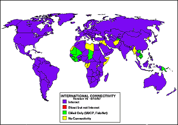
This right here is a statistical map which means that it is map that has some sort of measurement that the data can be plotted on to the map. Statistical maps can be used for all sorts of things like population density, temperature and international connectivity like the one above is showing. The pattern that this map shows is that pretty much all of the world uses internet while some uses other sources of connectivity.
No comments:
Post a Comment