Source - http://seeps.geol.ucsb.edu/pages/isopach.html
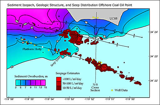
Isopach are maps that use thickness to measure a given variable over a period of time. The map above is a map of offshore coal and oil points that have an over abundance of sediment on the ocean floor, the pink area means the thickest while blue means thin. The pattern of this map is the the thickest part of the ocean floor is in the top left or the northwest corner.
No comments:
Post a Comment