Source - http://www.directionsmag.com/articles/choropleth-mapping-with-exploratory-data-analysis/123579
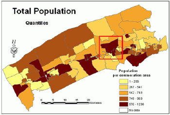
Standardized choropleth maps are devised to express the distribution of particular information over a specific area. In this map above it depicts a given are of their total number of people living within it. Seems that most of the population lives in about an evenly distributed of the entire county.
No comments:
Post a Comment