Source - http://wigenweb.org/oneida/tmap.html
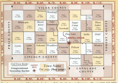
Public Land Survey System known for the acronyms PLSS are a way to divide, subdivide and describe land within the USA. Its divides land that is owned by the Federal government. It separates land into townships which are typically 6 square miles. Townships are subdivided into 36 one square sections. The land is surveyed through the north, south, east and west from the initial point. The picture above is a common way to depict a few counties with several townships for each county.
No comments:
Post a Comment